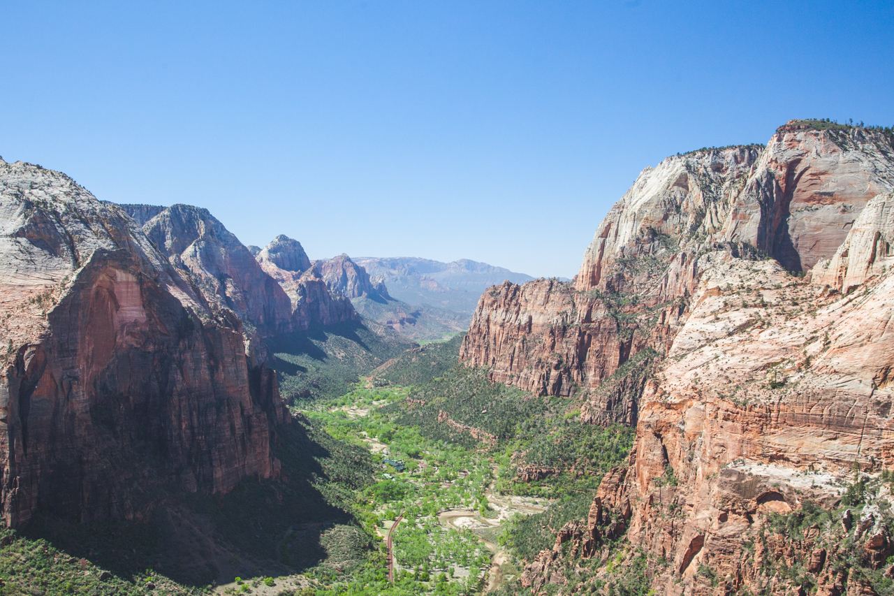
A View From the Top: Hiking Angels Landing in Zion National Park

A hike in canyon country with exposed trails, beautiful views, and a chance of a most certain death if you make a mistake makes for a great adventure when visiting Zion National Park. The only thing more dangerous than the trail itself is the thousands of tourists that flock to the trail every year.

Walters Wiggles

Formerly known as Temple of Aeolus, Angels Landing rises out of the Virgin River Valley to a height of 5,790 feet with an elevation gain of over 1500 feet. The rail starts at the Grotto Trailhead inside Zion National Park and is 2.4 miles long. The trail begins with a steep, but wide walking path that terminates at Scout Lookout. Most tourists turn around here and enjoy the views of the summit with very little risk of life or limb. Other more courageous individuals continue up the “chains” to the very top. We hiked this trail in April and the video from our climb is below:

The National Park Service formally recognizes 8 deaths that have occurred on Angels Landing, the most recent in Spring of 2018. Hikers often underestimate the steepness, iciness, or exposure level of the trail and have little options for turning around once they start the climb. Below are some tips to use to decide if you should attempt a hike up Angels Landing:

Insure that you are in good shape before attempting to hike AL- The Trail is steep, exposed, and often requires the use of yours hands to grab chains or to stabilize on nearby rocks. Being in poor fitness, i.e. not able to walk stairs without breathing heavily, will only magnify your difficulties on this trail.

Bring Plenty of Water- Zion National Park is located in the middle of the desert in Southwest Utah and temperatures during the day can reach 100F+. Bring enough water to hydrate the whole way up and back to the parking lot. Keep in mind that Zion National Park requires all visitors to park and ride a shuttle from the entrance of the park to the attractions within, so bring enough water to get you off the trail and back to your vehicle (up to 2 additional hours).

Angels Landing from below

Use the Appropriate Gear- The trail to Angels Landing can be icy for several months of the year and care should be given in the quality and type of footwear that you bring. Traction aids such as YakTraks should be considered if ice is present or simply rescheduling your hike to later in the season.  Wicking clothing is important during the rest of the year and a quality day pack or hydration bladder is very helpful for carrying several liters of water on the narrow trail.

Start Early in the Day- Like most trails in the National Park system, crowds of thousands of people will flock to the trailheads beginning at around 9AM. Set the alarm a little earlier, enjoy a cup of Rose Rock Coffee, and start the trail before sunrise to skip the crowds and enjoy some solitude at the top!

Angels Landing, although not overly technical is a dangerous and rewarding hike that requires a bit of thought before embarking. If you enjoyed our post, please stay a while and read about more of our adventures around the country. You can follow our travels more directly on Instagram and Facebook as well.

FREE Camping in Southern Utah

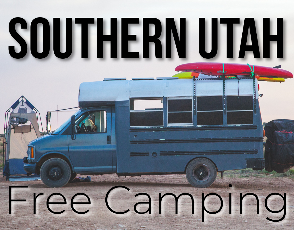
Southern Utah Free Camping


Mexican Hat BLM
GPS: 37.172547, -109.847076

If you are leaving Moab, UT and looking for something fun and interesting to see in Southeast Utah, check out Mexican Hat, UT. Mexican Hat is named as such for the rock formation that hangs over the San Juan River near the Arizona border. The campsites are spread out, level, and right on the river! We camped here while we explored the Mexican Hat formation and nearby Monument Valley area.

Make sure that you fill up fuel and water on your way South and enjoy the peace, quiet, and epic stars that this site offers. There are a bunch of places to pull off and park near the rock formation but follow the road off the highway and stay left. Wind around the formation and park in one of the spots down by the river.

Leprechaun Canyon BLM
GPS: 38.017952, -110.536982

Utah is known for a few things; arches, Mormonism, and slot canyons. If you made it through Utah far enough to consider this campsite, you have encountered the first two in abundance. Slot canyons are often tricky to find and even more tricky to get all to yourself. However, there are some hidden gems that most tourists don’t know about and this campsite is one of them. There are a couple of parking spots in the parking lot up the road and two or three spots near this canyon at mile marker 28.1.

This campsite is nothing the shake a stick at and is very close to the road. However, the real beauty of this spot is the proximity to the Irish Canyons; a series of slot canyons right off of the road. We stayed here overnight after checking out the Ghost Marina of Hyte and spent all day exploring the canyons nearby. Big rigs will have a hard time with this spot and to access the 2-3 spots that are farther off the road you should have a 4×4 and traction devices.

Burr Trail Road GSENM
37.848739, -111.370629

This is more of a gravel parking lot than a campsite, but it gives a good starting point for exploring Grand Staircase Escalante National Monument and the town of Boulder, UT. Make sure to stop in the http://burrtrailoutpost.com and get a cup of coffee and a gluten-free sandwich before hitting the trail. The proprietor was very knowledgeable of the area and offers great advice on local trails and points of interest.

Casto Canyon BLM
37.784196, -112.331790

This road and subsequent pull-outs are located a few miles down the road from Bryce Canyon and have many of the same geological features that makes Bryce famous. Some spots are better than others, but the nearby Casto Canyon and Red Canyon Mountain Bike trails make this spot a solid starting point for an adventure in Bryce country.

There are vault toilets along the road at different campsites and there are spots for larger rigs along the road. Be wary of the higher elevation; in mid-April we pulled in with 65° temps and woke up the next morning with snow and temps in the 20’s. This is very common for the high desert, so be prepared with plenty of fuel, water, and food.

Bryce Canyon FS
37.665426, -112.182836


Just before you get to the welcome sign for Bryce Canyon National Park, turn right onto Forest Service Road 090 and enjoy the hundreds of campsites and pull-outs along the road. Free camping this close to a National Park where camping can cost $50+ is a lifesaver.

There was plenty of downed wood and the spot that we stayed in was very secluded and quiet. There were spots for rigs of all sizes, just make sure that your fire is put out and that you don’t mutilate the live trees that are everywhere.


LaVerkin BLM
37.170866, -113.249931

When you think about public land camping in the desert, this is what you picture. Beautiful views, clean campsites, and tons of mountain biking nearby. This was one of our favorite campsites in Utah and for good reason. The JEM mountain bike trail wraps its way around the butte and river below to form a network of trails for running or riding.

Cell service was excellent here as well. We stayed here while getting errands run in Hurricane and visiting nearby Zion National Park. If we make our way back to the Hurricane area again, we will definitely stay here. If you stay here, be sure to check out the Virgin River overlook and rim trail. It is worth the effort to get to it.

If you use any of these free campsites on public land, pick up after yourself. Please follow Leave No Trace guidelines and leave the land better than you found it. If you liked our content and want to see more of our travel and full-time bus living, check out our Facebook and Instagram pages and subscribe to our YouTube Channel.

SaveSave

SaveSave

SaveSave

SaveSave

SaveSave

error

Enjoy our content? Help spread the word! ;)

Follow by Email
YouTube
YouTube
Instagram